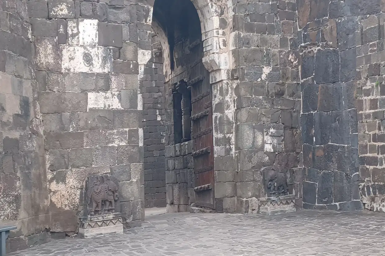
Daulatabad Fort – Complete Visitor Guide 2026 (Local Aurangabad Tips)
Daulatabad Fort sits 15 km from Chhatrapati Sambhajinagar (Aurangabad), directly on the road to Ellora, and is one of the most underappreciated military engineering achievements in Indian history. A 200-metre volcanic rock pinnacle, fortified and refortified by successive dynasties over centuries, with a deliberately designed dark tunnel approach to confuse and trap attackers — this is not a passive heritage stop. This guide covers what it actually is, what to expect, and why it deserves real time on your itinerary.
What Daulatabad Fort Actually Is
Daulatabad Fort is built on and around a steep, isolated volcanic rock hill rising approximately 200 metres above the surrounding Deccan plateau. The hill’s natural defensibility — a near-vertical rock face on most sides — made it a strategically prized site for centuries, with successive rulers expanding its fortifications: the Yadava dynasty, the Delhi Sultanate under Muhammad bin Tughlaq, the Bahmani Sultanate, and later Mughal administration.
The original name — Devagiri:
Before it became Daulatabad, the fort and surrounding settlement were known as Devagiri (“hill of the gods”), the name under which it served as the capital of the Yadava dynasty from the late 12th century. The name Daulatabad (“city of fortune”) was given after Muhammad bin Tughlaq’s historically significant attempt to make it the capital of the Delhi Sultanate in the 14th century.
The Tughlaq capital episode:
In 1327 CE, Muhammad bin Tughlaq ordered the transfer of the Delhi Sultanate’s capital from Delhi to Devagiri, renaming it Daulatabad. This involved the relocation of much of Delhi’s population over a journey of more than 1,100 km — an episode widely discussed in medieval Indian historiography, both for its human cost and for the fact that the capital was eventually moved back to Delhi. Regardless of the episode’s outcome, it left Daulatabad with significantly expanded fortifications built during the period of Sultanate investment.
💡 Tip: Knowing the Devagiri-to-Daulatabad name change, and the Tughlaq capital episode behind it, transforms the fort from “an old fort” into a specific historical event you are walking through. Ask your guide to point out which sections of the fortification date to the Tughlaq expansion versus the earlier Yadava core — the layered history is visible in the construction itself.
📍 Daulatabad Fort on Google Maps

The Defensive Engineering — Why This Fort Was Never Taken by Force
What makes Daulatabad Fort genuinely remarkable is not just its scale, but the layered, deliberate engineering designed to make a direct assault effectively impossible.
The moat:
A wide moat was cut around the base of the central hill, historically filled with water and, according to most historical accounts, populated with crocodiles as an additional deterrent against attackers attempting to cross.
The smooth scarp:
Above the moat, the lower portion of the hill itself was deliberately carved and smoothed into a vertical, unscalable rock face — a technique that converts the natural hill into an artificial cliff with no handholds or footholds for an attacking force to climb.
The dark tunnel:
The historical approach to the upper fort passes through a long tunnel cut into the rock, designed with deliberate twists, dead ends, and sections of complete darkness. Historically, defenders could block the tunnel’s exit and, if attackers entered, use defensive measures — smoke, fire, or simply the disorientation of total darkness in unfamiliar territory — to neutralize an invading force inside the tunnel itself before they ever reached the upper fort.
The result:
Daulatabad Fort has a historical reputation for being effectively unconquerable through direct military assault. Where the fort did change hands across its history, this typically occurred through siege, negotiation, or other indirect means rather than a successful frontal attack through its defensive layers.
💡 Tip: If you are claustrophobic or uncomfortable with bats and pitch darkness, you do not have to skip the summit. ASI has built a newer, open-air concrete staircase right outside the tunnel entrance that bypasses the dark passage completely while still taking you to the upper fort. Ask the staff at the tunnel entrance to point you to it if you would prefer this route.
Visiting Daulatabad Fort — Practical Information
Timings:
- Lower complex, lawns, and illuminated fort facade: Daily, 6:00 AM to 9:00 PM (part of ASI’s Night Tourism initiative)
- Upper fort and dark tunnel: Close strictly by 5:30 PM for safety reasons
If you want to attempt the climb, the tunnel, and the summit, plan to enter well before 5:30 PM. An evening visit after that time is still worthwhile for the lower complex and the illuminated facade, but the climb itself will not be accessible.
Entry Fee (2026, fully digital — cash counters closed):
- Indian nationals, SAARC, and BIMSTEC citizens (online): ₹25
- Foreign nationals (online): ₹300
- Children: Confirm current policy at entry
- Payment is via QR code/UPI or online booking — carry a working payment method, as cash is no longer accepted at the counter
What to wear:
Closed shoes with good grip are essential — the climb to the upper fort involves uneven stone steps, some steep sections, and the dark tunnel passage where footing needs to be secure without clear visibility. This is the one site in the Aurangabad heritage cluster that genuinely requires hiking-appropriate footwear, more so than Ajanta or Ellora.
Time needed:
2 to 3 hours for a proper visit, including the climb to the upper fort, the tunnel passage (or the alternative staircase), and time at the summit viewpoint.
Fitness consideration:
The climb to the upper fort is genuinely strenuous — a sustained ascent over uneven terrain, narrow passages, and steep stone steps. This is not a site for visitors with significant mobility limitations, and even reasonably fit visitors should expect to need rest breaks during the ascent, particularly in summer heat.
💡 Tip: Carry water — there is limited refreshment availability once you begin the climb, and the ascent in Maharashtra’s heat, particularly between March and June, is more physically demanding than it appears from the base.
📍 Daulatabad Fort on Google Maps
What to See — A Walking Guide
The outer fortification walls:
Before reaching the central hill, you pass through several concentric layers of outer walls and gateways — evidence of the fort’s expansion over centuries by successive rulers, each adding their own defensive layer around the original core.
Chand Minar:
A 14th-century victory tower, built by the Bahmani Sultanate ruler Ahmad Shah Wali Bahmani to commemorate the capture of the fort. Rising approximately 63 metres (210 feet), Chand Minar is the second-tallest minar in India after Delhi’s Qutub Minar, with Persian-influenced architectural detailing. Entry inside the tower and climbing it is no longer permitted for safety and structural conservation reasons — you can view and photograph it from outside.
Chini Mahal:
A ruined palace structure within the fort complex, historically notable as the place where Abul Hasan Qutb Shah, the last ruler of the Golconda Sultanate, was imprisoned by Aurangzeb following the Mughal conquest of Golconda in 1687. The same prison also held the young Chhatrapati Shahu Maharaj — grandson of Chhatrapati Shivaji Maharaj — during his early years in Mughal captivity, alongside his mother. Given that the city itself is now named Chhatrapati Sambhajinagar, this connection between the fort and Maratha history adds a meaningful local dimension to the site beyond its Sultanate and Mughal associations.
The moat and scarp:
Before entering the tunnel, take a moment to look at the carved scarp and the moat below — understanding the scale of this deliberately engineered obstacle before passing through it gives important context to what follows.
The dark tunnel (or the bypass staircase):
The defining experience of a Daulatabad visit for most travelers. The tunnel’s twists and sections of complete darkness should be navigated carefully and unhurriedly. If darkness, bats, or confined spaces are not for you, the open-air staircase just outside the tunnel entrance reaches the same upper fort without the passage.
The upper fort and summit:
After the tunnel or staircase, the path continues upward to the fort’s highest fortifications and eventually the summit, where a cannon platform and the remains of further defensive structures offer a commanding view over the Deccan plateau, toward Chhatrapati Sambhajinagar (Aurangabad) in one direction and, on clear days, toward the Ellora escarpment in another.
💡 Tip: The view from the summit, looking back down at the moat, the scarp, and the layered fortification walls you have just climbed through, is when the full scale of Daulatabad’s defensive engineering becomes genuinely apparent. Take time at the top rather than immediately starting the descent.
Daulatabad Fort and the Aurangabad Name Connection
Daulatabad Fort has a direct historical connection to the city of Chhatrapati Sambhajinagar (Aurangabad) itself, beyond simple geographic proximity. The broader Devagiri-Daulatabad region was a significant administrative and military center for successive dynasties controlling the Deccan, and the nearby city — which grew under Mughal administration during Aurangzeb’s extended Deccan campaigns — developed in direct relation to the fort’s strategic and administrative importance. The fort’s later role in Maratha history, including its association with Chhatrapati Shahu Maharaj, connects directly to the city’s current name.
Understanding Daulatabad Fort, in other words, is understanding a significant part of why Chhatrapati Sambhajinagar (Aurangabad) exists and developed where it did.

Combining Daulatabad Fort With Other Sites
Daulatabad Fort sits directly on the road between Chhatrapati Sambhajinagar (Aurangabad) and Ellora, making it the most naturally combinable heritage site in the region.
Daulatabad Fort + Ellora Caves:
The standard and most efficient pairing. Visit Daulatabad Fort in the morning before continuing to Ellora, or stop on the return journey if your energy is better suited to Ellora first. Either sequence works given the short distance between the two — just plan the fort climb before 5:30 PM regardless of sequence.
Daulatabad Fort + Grishneshwar Temple + Ellora:
For a complete Ellora-region day, combining all three — fort, temple, and caves — is achievable given their close geographic proximity, though it requires reasonably efficient time management at each stop.
👉 See Aurangabad Heritage Tour Details & Book — Daulatabad Fort, Grishneshwar Temple, and Ellora Caves in one well-paced day.
The Alternative — Daulatabad With Someone Who Knows the Tunnel
The dark tunnel section of Daulatabad Fort specifically benefits from local knowledge — knowing which sections require extra caution, where the bypass staircase is if needed, and the historical context of exactly how this passage was used defensively makes the experience considerably richer than navigating it without guidance.
A guided visit also means a properly paced ascent — knowing where rest points are useful, how long the full climb genuinely takes, and ensuring you do not miss Chand Minar or the Chhatrapati Shahu Maharaj connection at Chini Mahal en route to the tunnel and summit.
👉 See Aurangabad Heritage Tour Details & Book — Daulatabad Fort with full historical context, paired with Ellora and Grishneshwar Temple.
FAQ — Daulatabad Fort Complete Guide
Q.1 : Is Daulatabad Fort worth visiting?
Yes — Daulatabad Fort is one of the most significant medieval military engineering sites in India, with a 200-metre fortified rock pinnacle, a deliberately disorienting dark tunnel defense, and a direct historical connection to the Tughlaq dynasty’s attempted relocation of the Delhi Sultanate capital in the 14th century, as well as Maratha history through Chhatrapati Shahu Maharaj. It pairs naturally with an Ellora Caves day trip given its location on the same road.
Q.2 : How difficult is the climb at Daulatabad Fort?
The climb to the upper fort is genuinely strenuous, involving uneven stone steps, narrow passages, and a dark tunnel section requiring careful footing without clear visibility. Visitors uncomfortable with darkness or confined spaces can use the open-air bypass staircase next to the tunnel entrance instead. Closed shoes with good grip are essential, and water should be carried given limited refreshment availability during the ascent.
Q.3 : What is the dark tunnel at Daulatabad Fort?
The dark tunnel is the historical defensive approach to the upper fort, cut into the rock with deliberate twists, dead ends, and sections of complete darkness, designed to disorient and trap attacking forces. An alternative open-air staircase now exists just outside the tunnel entrance for visitors who prefer to bypass the dark passage while still reaching the upper fort.
Q.4 : What is the history of Daulatabad Fort?
Daulatabad Fort was originally known as Devagiri, capital of the Yadava dynasty from the late 12th century. In 1327 CE, Muhammad bin Tughlaq renamed it Daulatabad and ordered the Delhi Sultanate capital relocated there. The fort later held Abul Hasan Qutb Shah, the last ruler of Golconda, as a prisoner at Chini Mahal, and also held the young Chhatrapati Shahu Maharaj during early Mughal captivity — directly connecting the fort to the Maratha history that gives the nearby city its current name, Chhatrapati Sambhajinagar.
Q.5 : What are the current timings and entry fees for Daulatabad Fort?
As of 2026, the lower complex and illuminated facade are open daily from 6:00 AM to 9:00 PM under ASI’s Night Tourism initiative, but the upper fort and dark tunnel close strictly by 5:30 PM for safety. Entry is fully digital: ₹25 for Indian nationals, SAARC, and BIMSTEC citizens, and ₹300 for foreign nationals, paid via QR code/UPI or online — cash is not accepted at the counter.
👉 Related Posts You Might Like:
- Bibi ka Maqbara – Complete Visitor Guide
- Grishneshwar Temple + Ellora Caves – Half Day Combo Guide
- Kailasa Temple – How It Was Built (The Engineering Mystery)
- Ellora Caves in One Day – Exact Itinerary
- Top 10 Tourist Places in Aurangabad